Fugro GEOS: Leading Metocean Data Solutions for Offshore Safety
Exploration and exploitation of data
Given the potentially hazardous environment of offshore regions, operational decisions have to be based upon the information at hand and there is a critical need for such data to be as up to date and accurate as possible.
As the world’s leading supplier of meteorological and oceanographic (metocean) services for offshore and coastal engineering applications, Fugro GEOS bridges the gap between these data and the needs of its clients. Drawing upon its skilled staff base and the world’s largest commercially available inventory of metocean measurement equipment, Fugro GEOS can put together solutions that incorporate advanced measurement, consultancy, information, monitoring, and forecasting services.
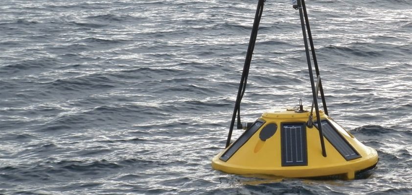
The company’s systems are designed to provide easy access to metocean and environmental data to help clients in their operational planning. For more than 20 years Fugro GEOS has been designing, installing and maintaining reliable, real-time measurement systems that monitor environmental conditions. These range from single sensors to multi-parameter, multi-site networks, which have been applied in a variety of locations across the world.
One of Fugro GEOS’ most recent software advancements has been its new Metis system, which is a web-based presentation solution built upon geographic information system (GIS) technology. This enables metocean data from different sources to be viewed in a single display – not just point data, but also other formats such as model data. Mark Calverley, consultancy director at Fugro GEOS, elaborates on how Metis provides the common data platform that this sector has traditionally lacked: “We deal with many different data types – from model data to aerial photography and satellite imagery – so the information is received in a variety of ways. The challenge for us is to tie all the data together so it can be delivered through one single platform. Having this common platform can increase the value of those individual data sets by an order of magnitude.”
Currently the Metis system is being used on a number of contracts to deliver both weather forecasting data and real-time information. The scope for the programme continues to grow as Fugro GEOS identifies new opportunities for this data. One such development was sparked by the impact on Fugro GEOS of the Macondo oil spill incident in 2010. Drafted in to respond to this crisis, the company extended its expertise beyond that of an oceanography business supporting rigs, to provide environmental monitoring of the spill itself.
“This has given us an invaluable insight into spill response and some of the issues faced during such an incident. As a result, over the last 12 months we have been working to bring together several Fugro business lines to create a new service to this market. This includes using satellite imagery to detect spills, modelling frameworks to aid contingency planning, using our satellite data capability to look at coastal vulnerability and habitat classification and in situ measurements in the event of an incident. Another component we’ve been involved in is the use of aerial surveys to delineate oil spills. All of these disparate data types and information will be delivered through our Metis system,” explains Mark.
Another area Fugro is targeting is the Law of the Sea and the increasing potential for oil companies to license, explore or develop acreage that is claimed by two or more countries. This brings with it significant financial and political risks, so Fugro’s Law of the Sea expert aims to make essential information accessible through the Metis web presentation system, supported by more in-depth consultancy, reports and workshops.
In traditional oil and gas regions, Fugro GEOS’ projects continue to progress well, with two long-term metocean contracts underway for Statoil in the North Sea and the Norwegian Sea. The company is also beginning work in a very different part of the world, having been awarded a year-long contract for deepwater current measurements in Vietnam. This is a challenging area from an oceanographic perspective as it can be subject to solitons (internal waves) that give rise to high current speeds. The data will be used for future exploration drilling operations, as well as design, if development plans are instigated.
Over the last few years Fugro GEOS has also broadened its market with business in Australia, Brazil and frontier areas such as Columbia and East Africa. Within these emerging markets the company has become particularly renowned due to the far greater environmental challenges compared to more mature basins. “We’re in quite a unique position in terms of the range of services that we can offer,” comments Mark. “Our holistic solutions offer greater value through exploitation of the data and making it more readily available to the different audiences within our client base.”
In order to continue in this vein, he concludes with a hint about Fugro GEOS’ next line of development: “We’re creating a range of in-house models, such as atmospheric, wave and current models, to specifically address some of the shortcomings we see in public models or those provided by other parties. The models feed right through our business from forecasting into consultancy works, as well as Metis, so we can deliver access to data that historically has been quite cumbersome to acquire through the delivery of hard drives and software packages.”
Fugro GEOS
Services: Meteorological and oceanographic solutions